
Shelter
Åsevang, Shelterplads Syd
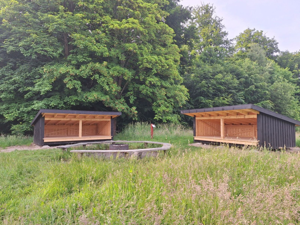
At the shelter there is a campfire site with a grill and a table and bench set. There is another shelter on the site that can be booked separately.
Bring bags to collect your own waste, toilet paper and wet wipes.
Leave the site cleaned as you wish to find it.
The site is located high on a meadow with a forest surrounding it and near Furesø.
In the summer months, water can be collected from the tap at the fire hydrant on the road at Ved Kulhus. Located approx. 600 m from the road at Ved Kulhus.
It is allowed to collect small wood for firewood, but if you want to be sure of something that is dry, you should bring your own firewood or charcoal.
It may be a good idea to bring a small saw and a small splitting axe as well as firewood. Never saw in living trees!
You are welcome to pitch a few smaller (2-3 pers.) tents on the site if there are more of you.
Please follow the instructions on the information sign at the site.
There is a primitive earthen toilet on the other side of the meadow, bring your own toilet paper and wet wipes.
As there is a private neighbor just south of Åsevang, please do not stay closer than 100 meters from the house.
**Advance booking:** You can book priority accommodation in the shelter.
You can stay in the shelter for a maximum of two nights in a row.
You only book one shelter. Others can also use the facilities and pitch a tent on the site and share a campfire.
Bookings can be made no earlier than 3 months before the overnight stay.
When booking, you must use the shelter before 8 p.m., otherwise your priority will lapse.
**Access conditions:** The nearest parking lot is at Frederiksborgvej/Ved Kulhus.
**Nature guide to the area:** <https://naturstyrelsen.dk/find-et-naturomraade/naturguider/hovedstaden-og-nordsjaelland/noerreskoven-ved-furesoe>
The shelter was built with support from the A.P. Møller Foundation.
<span style="background-color: rgb(255, 255, 255); color: rgb(33, 37, 41);"></span>
Features
- Booking possible
- Sleeps 6
- Nearest natural water: 281 m
- Nearest road: 497 m
Location
55.780989, 12.414453 - Open in Google Maps