
Shelter
Shelter i Gellerup Skov
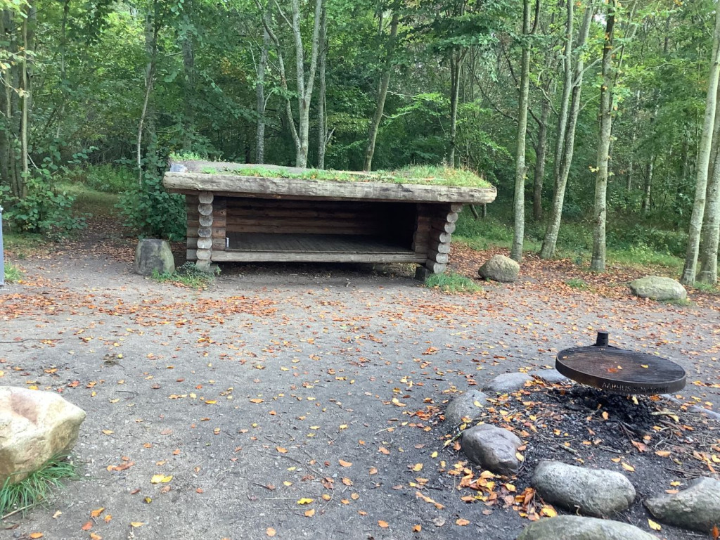
The shelter belongs to Aarhus Municipality and can be booked via [Book Naturen](https://booknaturen.aarhuskommune.dk/sted/shelter-i-gellerup-skov/?s1=3012&s2=20/01/2026)
Gellerup Forest was established in 1989 and covers an area of 22 hectares. In the forest there is a large grassy plain with fine flora, and if you are lucky, you can see deer when you go for a walk in the beautiful oak forest. In the forest there is a running route in the shape of a figure of eight, which is approximately 1.7 kilometers long. Various activity equipment has been set up along the running route.
The shelter site is located on a small grassy area surrounded by trees, which gives the impression of being in a cave. In front of the shelter is the campfire site.
**Practical information:**
• If you have booked a shelter, you have automatically booked the associated campfire site.
• You must bring your own firewood from home.
• You are welcome to collect dry branches from the forest floor.
• There are no waste, water or toilet facilities at the shelter.
• Please take your own waste home, so remember to bring garbage bags.
**Route directions**: Parking is available at the entrance to Snapagervej. From here, follow the path to the left into the forest. After approx. 250 m. you will come to a crossroads - turn left. After approx. 130 meters you will see a footpath on the left, which leads into a cluster of beech trees. The shelter site is located between the trees. From the parking lot it is approx. 5-10 min. walk to the site.
**GPS**: 56°09'01.0"N 10°08'32.0"E
Features
- Sleeps 6
- Nearest natural water: 36 m
- Nearest road: 150 m
Location
56.150408, 10.142253 - Open in Google Maps