
Shelter
Shelter i Hørhaven i skoven
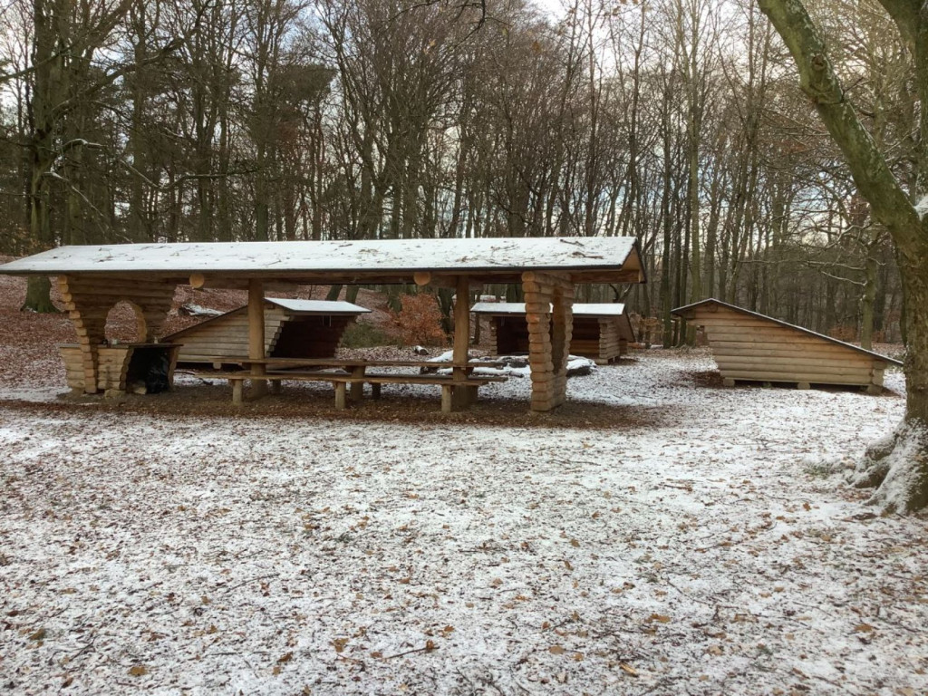
The shelters belong to Aarhus Municipality and can be booked via [Book Naturen](https://booknaturen.aarhuskommune.dk/sted/shelter-i-hoerhaven-i-skoven/)
Hørhaven is an open grassland with scattered trees and bushes, located close to the coast. There are good opportunities for outdoor activities on the open grassy area. From the area there is a staircase that leads down to the beach. Hørhaven is a protected natural area due to the area's fine grassland character and flora.
There is a large open space in front of the three shelters, which makes the place ideal for playing and other activities. The shelter site with its accompanying campfire site and covered long table with benches is located secluded in the old beech forest.
For day events with more than 50 participants, you can also book the other shelters in Hørhaven at [Book Naturen](https://booknaturen.aarhuskommune.dk/).
If you need more places to stay, you can also book "Shelter in Hørhaven on the hill" with accommodation for up to 8 people.
**Practical information:**
• If you have booked the shelters, you have automatically booked the corresponding campfire site.
• You must bring your own firewood from home.
• You are welcome to collect dry branches in the forest floor.
• You must take your own waste home, so remember to bring garbage bags.
• Toilet facilities at the parking lot at DUI's holiday camp.
• There are parking options at DUI's holiday camp.
**Route instructions**:
Start at the entrance to Hørhaven at the parking lot at DUI's holiday camp Peter Sabroes Minde. Walk approx. 75 meters east past the barrier and past the holiday camp - here the gravel road branches off as a track runs in a northerly direction and continues east. Follow the track that goes in a northerly direction (left) for approx. 200 meters. The shelter is located in the forest in the northernmost corner of Hørhaven.
**Nearest address**: Ørneredevej 23, 8270 Højbjerg
**GPS**: 56°06'52.5"N 10°13'38.0"E
Features
- No drinking water
- Sleeps more than 15
- Nearest natural water: 152 m
- Nearest road: 143 m
Location
56.11467, 10.22718 - Open in Google Maps