
Shelter
Dagshelter i Hørhaven
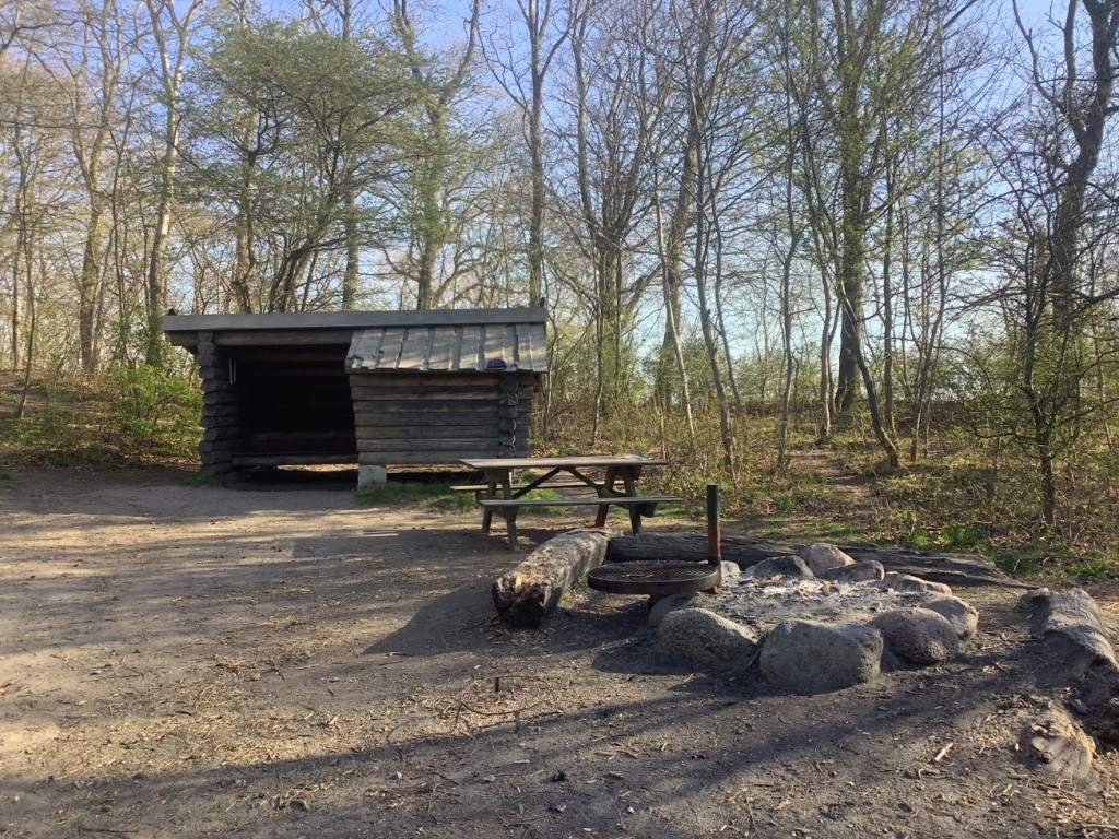
The shelter belongs to Aarhus Municipality and can be booked via [Friluftsliv Aarhus](https://friluftslivaarhus.dk/)
The shelter is located in an open connection with the grasslands in Hørhaven. Day shelters are built with staggered floors and are therefore not suitable for overnight stays. However, the shelter is very suitable for day trips for schools and institutions. In front of the shelter is the campfire site, which is free to use.
Hørhaven is an open grassland with scattered trees and bushes, located close to the coast. There are good opportunities for outdoor activities on the open grassland. There are two more shelter areas in Hørhaven. From the area there is a staircase that leads down to the beach. Hørhaven is a protected natural area due to the area's fine grassland character.
For day events with more than 30 participants, you can also book Hørhaven at [Brug Aarhus](https://brugaarhus.dk/), and possibly supplement by booking the other shelters in Hørhaven at [Friluftsliv Aarhus](https://friluftslivaarhus.dk/).
Practical information:
• If you have booked a shelter, you have automatically booked the associated campfire site.
• You must bring your own firewood from home.
• You are welcome to collect dry branches from the forest floor.
• There are no waste, water or toilet facilities at the shelter.
• You must take your own waste home, so remember to bring garbage bags.
• Toilet facilities at the parking lot at DUI's holiday camp.
**Route directions**:
• Start at the entrance to Hørhaven at the parking lot at DUI's Peter Sabroes Minde holiday camp
• If you are driving, there are good parking options here, but the area can also be easily reached by bike and bus
• Walk approx. 75 meters east past the barrier and past the holiday camp – here the gravel road branches off into a track running north and another continuing east. Follow the track straight ahead (east). After 40 meters, turn left onto a small path towards the sea. 75 meters along this path you will find the shelter on the edge of the forest near the coastal cliff.
• Nearest address: Ørneredevej 23, 8270 Højbjerg
**GPS**: 56°06'48.8"N 10°13'48.7"E
Features
- Nearest natural water: 53 m
- Nearest road: 137 m
Location
56.113568, 10.230217 - Open in Google Maps