
Shelter
Lyne Friskole/ Shelter/lejrplads
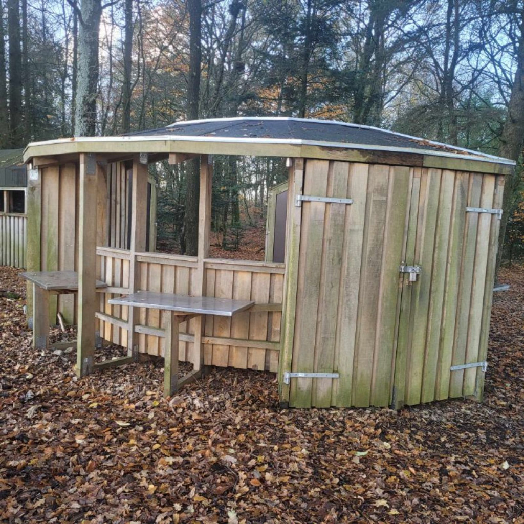
On Knudevej 2, behind the farm in the forest and close to a small lake by the school track:
<https://spor.dk/raunkjaer-knude>
near Lyne, 2 cabins have been established with room for 12-14 overnight guests, a fire house and 1 multi-purpose toilet. You can park at the yard from the asphalt road on the grass in front of the yellow building.
A wonderful place close to flora and fauna. Wild edible plants can be collected here, as the trail is part of the "Wild edible trail" under vildmad.dk - download the Wild Food app.
Follow the route and discover an exciting part of West Jutland's nature and culture, i.a. with the memorial park at Raunkjærgård, where there is a memorial stone for the great Danish botanist, Christen Raunkjær, who developed methods to determine the plants of an area. On the route there is also an old protected animal pen from the time of the bull drivers, where a set of table benches has been set up. Here you can sit down and enjoy the silence close to the old oak trees and in the middle of the heather. Or you can go for a walk on an old road from ancient times.
The area is also used as an outdoor school for Lyne Friskole: <https://lynefriskole.dk/>
A large insect hotel will also be built in 2023, which is part of the nationwide insect hotel chain: https://www.landbrugslotteriet.dk/om-lotteriet/stotte-til-gode-formal/insekthotel-i-Lyne
There is a "Min Købmand" on Vardevej 92 in Lyne by approx. 3 km from the square. There is also a guest house [www.gæstehuset.dk](http://www.xn--gstehuset-g3a.dk/) with overnight accommodation, a petrol station etc.
See also other cycling and walking routes in the area: <http://lyne.dk/wp-content/uploads/2018/03/Lynefolder.pdf>
If you want to know more about the school track, the camp site and the outdoor school, call or email:
Lyne Friskole at 75250011/[email protected] or
Karen Raunkjær at 25774156/[email protected]
Features
- Drinking water
- Booking possible
- Sleeps 14
- Nearest natural water: 147 m
- Nearest road: 174 m
Location
55.817148, 8.529442 - Open in Google Maps